
New flood mapping which has been drafted with the help of the community will be available to review as part of Bundaberg Regional Council’s involvement in a catchment- wide flood study.
The updated flood models are being developed as part of the Burnett River and Tributaries Catchment Flood Study, which is jointly funded by the Australian and Queensland Governments.
Bundaberg Regional Council is working collaboratively with other Council’s within the Burnett River catchment as well as consultants, AECOM Australia Pty Ltd, to deliver the study.
The purpose is to provide a better understanding of flood behaviour which in future, can be used to improve flood management and response, and provide up-to-date information for land-use and infrastructure planning.
The first phase of the study, completed in October 2024, focused on gathering community experiences and information of past floods. Mayor Helen Blackburn said, along with newly available data, this information has been used to update the flood modelling of the Burnett River and major tributaries.
“Your stories and data have been incredibly valuable,” she said.
“The feedback we received will play a critical role in shaping our understanding of flood behaviour in the region.”
The study has now reached Phase 2 where, using the data collected from Phase 1, new flood models of the Burnett River have been created.
“Now, we need to make sure that the models can predict floods accurately,” Mayor Blackburn said.
“Our officers do this by comparing the model’s predictions with what actually happened in past flood events, like the January 2013 floods.”
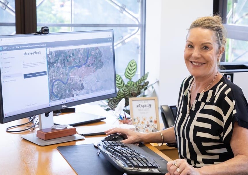
The project consultants have developed flood maps showing historical floods of the Burnett River.
To confirm these flood maps accurately represent what happened, Council is again asking for community input.
“As part of Phase 2 of the study we are again calling on your local knowledge to ensure that the maps are accurate,” Mayor Blackburn said.
“Do the maps reflect your experience of past floods? Let us know.
“Your feedback will help us refine our understanding and improve future flood management and response.”
Consultant AECOM has launched a project webpage where the community can view information about the project.
The community will be able to review the flood maps and provide feedback online between 21 April and 16 May 2025.
A community consultation session will also be held, offering the opportunity to discuss the maps and share additional insights directly with Council and the Flood Study team.
When: Friday, 2 May 2025 between 7.30 am to 2.30 pm
Where: Civic Centre Super Room, 190 Bourbong Street, Bundaberg
Mayor Blackburn highlighted the importance of the study.
“We are committed to building a safer, more resilient community,” she said.
“These new flood maps are crucial to improving our response to future flood events and ensuring that we are better prepared.
“I encourage all community members to get involved and provide their feedback.”
More information
The Burnett Catchment Council’s Working Group (comprising Bundaberg Regional, North Burnett Regional, South Burnett Regional, Cherbourg Aboriginal Shire, and Gympie Regional Councils) is working together with AECOM Australia Pty Ltd, one of Australia’s leading engineering Consultants, who have been engaged to deliver the Flood Study.
The study will be carried out for the remainder of the year and into 2026, with the final outcome presented to the community in mid-2026.
The flood study is jointly funded by the Australian and Queensland Governments under the Disaster Recovery Funding Arrangements Flood Risk Management Program. Support for flood-affected residents
Residents who have been impacted by floods and are seeking support can contact Lifeline on 13 11 14 or Beyond Blue on 1300 22 4636. Aboriginal and Torres Strait Islander residents can call 13 YARN for support.


Is there such thing as predicting floods. If the rain falls in a somewhat different amount in different areas it will change. Some areas will always flood if the rain hits the right area while others may not.
–
For instance 2011 floods were a good 30CM higher then the 2013 floods in my area. I was barely effected in 2013. Meanwhile there was significant floods across most of the state sense then & most of Bundaberg was untouched.
With Paradise DAM currently still lowered it is now offering no flood buffer yet we have not flooded even during the recent event that flooded most of the state again.