
South Kolan Cemetery, located on Gin Gin Road at South Kolan, was gazetted in 1879 to service the needs of the growing community that developed in the region in the 1870s and 1880s.
As a significant marker of the history of the region, South Kolan Cemetery is listed on Bundaberg Regional Council’s Register of local heritage places.
Development of South Kolan
The area of South Kolan, around 20 km west of Bundaberg, was originally part of the Colanne pastoral property occupied by Robert Tooth in 1861.
It was situated on the Bundaberg-Mount Perry Road, which connected the copper mine at Mount Perry to the port of Bundaberg from the early 1870s.
As land was taken up from 1872, community infrastructure began to be established including a State school in 1878, a blacksmith shop in c1880 and the first church in 1882.
A Cemetery Trust was elected in 1881, and the cemetery is still administered by the trust to this day.
The Bundaberg-Mount Perry Railway was also completed in 1884, running parallel with the road.
Bingera Sugar Mill was erected in 1885 by the Gibson family, a development which had a further impact on the growth of South Kolan.
Various commercial premises, including butchers and a hotel, were opened in 1885, followed by a police station in 1888.
By 1895 there were four post offices, State school, two hotels, three churches and a combined police station and courthouse.
Early newspaper reports detail the lives and deaths of some South Kolan residents interned in the cemetery, including 19 year old Christian Dahl who died by accident in 1889 and members of the prominent Gibson family.
Physical Location
The South Kolan Cemetery is located on a levelled site bounded by Gin Gin Road to the south and Koolboo Road to the east.
The full site is 8 hectares with approximately one third cleared and the remainder forested bushland.
The cleared grassed area is fenced with a post and three-wire fence, with vehicle access from the road via a metal gate and pedestrian entry through a timber turnstile.
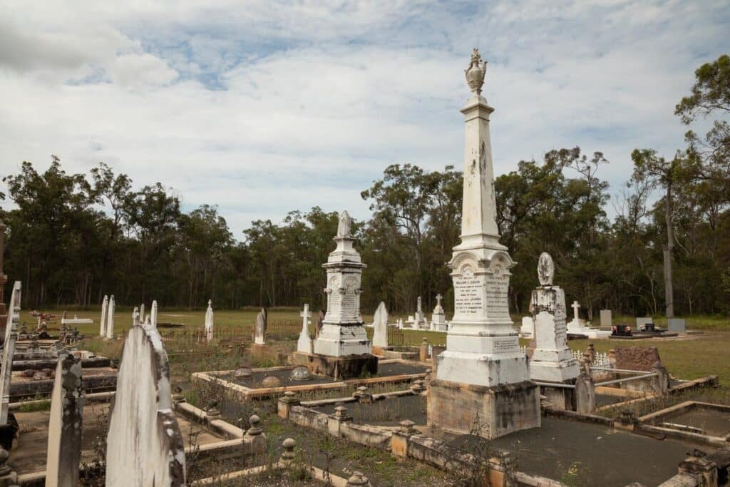
Marked graves are located on the eastern side of the cleared area, and there is also a small lawn section.
Grave surrounds include concrete borders, some with elaborate decoration, wrought iron, timber and chain fencing, and piping suspended between pillars.
Besides mounted tablets there are a large proportion of elaborate stelae and monuments.
Graves and memorials in the cemetery date from as early as 1878, and a number of gravesites have deteriorated and are only marked by metal plot numbers.
The cemetery has a special association with the South Kolan community having been used as a burial place for the region for more than one hundred years.


