

Situated on the Kolan River and just 25 minutes out of Bundaberg, Bucca Crossing is known today as a freshwater swimming spot.
Featuring a picnic area, car park and ample space to explore, the area is popular with locals and visitors alike.
It was first officially recognised in the late 1890s as the Bucca district began to grow and the area brought about a variety of agricultural pursuits.
Bucca Crossing utilised as township grows
According to Bundaberg Regional Council’s Local Heritage Places report, Bucca Crossing had been in use since at least 1885 for mail delivery and was formally recognised in 1890.
To better serve the local farmers transporting sugar cane to the mill, the crossing underwent significant improvements in 1896.
These enhancements were funded by Mr. Frederick Buss, owner of the Invicta Mill, and Mr. Johnstone of the Colanne Station, with the Gooburrum Divisional Board overseeing the work.
Bucca Crossing was not only a practical infrastructure but also a cherished communal space.
Recognising its beauty, five acres of land at the crossing were declared a recreational reserve in 1906.
However, by 1930, the crossing had fallen into disrepair.
The Bucca Local Progress Association’s appeals led to the construction of a new concrete crossing, opened in 1932 by Horace Buss, son of Frederick Buss.
This project was part of an unemployment relief scheme during the Great Depression.
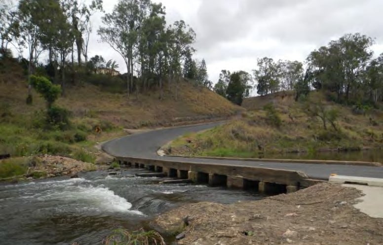
Today, Bucca Crossing connects Bucca Crossing Road in the south to Bostons Road on the northern side of the Kolan River.
The Bucca Crossing park reserve spans both sides of the river, offering landscaped areas, picnic facilities and car parking.
The crossing itself, with its reinforced concrete structure, stands as a testament to the region’s history and its evolution.
Bucca Crossing symbolises the district’s journey from early settlement to a thriving sugar cane farming community.
It illustrates the region’s development through the construction of vital transport infrastructure, facilitating economic growth and closer settlement.
Related stories: The history of Kirby’s Wall


no mention of the man named BUCCAH that comes from old historical records. so sad.
Hi there was apparently another crossing at the end of the road where Invicta mill was located.
Love Bucca crossing history local news