
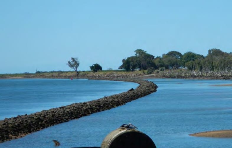
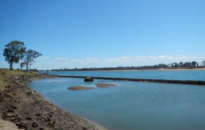
Kirby’s Wall stands as a historical landmark along the Burnett River, fronting the eastern bank and extending northwest of Paddy Island in the suburb of Kalkie.
The slightly curved wall spans approximately 1.5 kilometres and is made from mounted volcanic rocks that rises above the water level, effectively blocking off a cove adjacent to the river flats.
The creation and significance of Kirby’s Wall is an important part of the history of Bundaberg and its development as a key port city.
Early beginnings of Bundaberg
According to Bundaberg Regional Council’s Local Heritage Places report, Bundaberg was established in the late 1860s, and brothers John and Gavin Steuart played a pivotal role in the region’s early development.
Securing a contract to supply timber for tallow casks, the Steuarts established a camp in North Bundaberg in 1866 and erected a sawmill the following year.
Interest in the area grew rapidly, and by 1868, a town was surveyed on the southern bank of the Burnett River, laying the foundation for the present-day city of Bundaberg.
The late 1860s saw the first vessels navigating the Burnett River to reach the nascent settlement, facilitated by the Steuart brothers’ selection of land.
The Steuarts also constructed the first wharf on the north bank of the river, serving as an outlet for copper mined from Mount Perry and timber milled at various sawmills.
By 1871, Bundaberg was declared a port, and navigation of the river was further enhanced with the construction of a lighthouse at Burnett Heads in 1873.
Challenges and construction of Kirby’s Wall
The development of the port faced significant challenges, particularly due to silting of the Burnett River.
Dredging efforts were continually undermined by successive floods, most notably the devastating flood of 1893.
The river banks, especially at Kirby’s Flats on the south bank across from Paddy’s Island, suffered considerable erosion.
In response to these issues a Harbour Board of Advice was formed in 1895, followed by the establishment of a Harbour Board in 1896.
The board quickly initiated the construction of training walls, with four walls completed around 1900, including the now-known Kirby’s Wall.
Despite these efforts, the Burnett River continued to experience severe flooding, with the flood of 1942 being particularly destructive.
To mitigate these recurring problems, the port of New Bundaberg was opened in 1958, featuring a bulk sugar terminal.
Legacy of Kirby’s Wall
Kirby’s Wall remains a significant historical structure, illustrating the evolution of Bundaberg as a port city and the ongoing efforts to maintain its operational efficiency.
The wall is a testament to the engineering challenges faced in the nineteenth and early twentieth centuries, as well as the industries that relied on the river, such as sugar mills and foundries.
Today, Kirby’s Wall stands as a reminder of Bundaberg’s maritime heritage and the legacy of its early settlers and laborers who shaped the region’s history.


very poor indeed. no mention of the 1882 period that also gives some very relevant details in regard to the Kirby House. i did some notes years ago for the library from documentation, so what became of those notes, tossed out i guess.